Navigating City Planning and Zoning: Brevard's Innovative Journey with enCodePlus
When the staff of Brevard, North Carolina, was looking for a company to host their planning and zoning documents online, they discovered the versatile design capabilities of enCodePlus. They were thrilled that they could publish all types of documents, from the text-heavy Code of Ordinances to the completely image based
Public Infrastructure Details to the carefully formatted Comprehensive Land Use Plan, all in one web portal.
Throughout 2023, Brevard’s portal grew to include their Code of Ordinances, Unified Development Ordinance, Comprehensive Land Use Plan, Pedestrian and Bicycle Plan, and Public Infrastructure Details, plus some
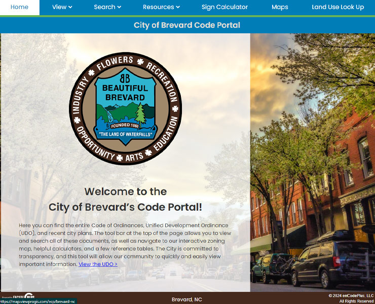
premium features to aid understanding. The portal’s search feature allows users to quickly find specific information in one or more documents. A Sign Calculator helps developers identify the signage requirements for a specific proposed project. Links to various resources grant easy access to relevant pages on the city’s
official government site as well as a quick overview of tables in the Unified Development Ordinance. The Land Use Lookup tool identifies where in the city specific use types are permitted and connects to the city’s interactive map for easy visualization of district locations. The map also has District Summary and Parcel
Summary features that help users quickly identify minimum building dimensions and design standards based on a chosen zoning district.
enCodePlus helps the city of Brevard maintain their commitment to transparency by presenting each document as it is meant to be seen and providing tools to make navigating and understanding the regulations easier for the public.
ENHANCED TECHNOLOGY
INTERACTIVE PRESENTATION
INTEGRATED TOOLS
“The intricate enCodePlus software allow us to match almost any existing plan document layout.”
PROJECT DETAILS
City of Brevard
95 W. Main Street
Brevard, NC 28712
Key Personnel: Sharon Cadena, Client Care & Operations Manager Alexys Irwin, Lead Build Associate Vanessa Otero, Designer